
Regular cameras and sensors produce 2D RGB images; there is no easy way to extract information on depth and distance. It is possible to estimate 3D depth information from RGB images, but their error tends to be too high for critical use cases such as autonomous vehicles.
The solution to this depth estimation problem is to capture objects in 3D as they are, not in the flat form of 2D. This provides the necessary real-time coordinates, distance, and timestamps for robots and self-driving cars to build a model of their environment in real time.
The most common technology used for building 3D maps is LiDAR. LiDAR (Light Detection and Ranging) is a remote-sensing technology that uses laser beams to measure precise distances, movements, and structures in an environment in real time.
In this beginner-friendly introductory guide, we will cover:
- What is LiDAR?
- How it works?
- LiDAR Types
- LiDAR Applications
What is LiDAR?
LiDAR works on the same principle as RADAR (Radio Detection and Ranging, a location system used by ships and planes) and SONIC (Sonic Navigation and Ranging, a system used by submarines). They all emit waves of energy to detect and track objects.
While RADAR uses electromagnetic waves (microwaves, to be exact) and SONIC uses sound waves, LiDAR uses lasers and reflected light. You get a 3D point cloud where every point has coordinates and sometimes reflectance. This way, you get depth data that is more reliable than RGB images, especially in poor light or harsh weather.
LiDAR technology has been used on airplanes to scan the territory they flew over since the 1960s. With the advent of GPS (Global Positioning System) systems in the 1980s, LiDAR started being used to calculate distances and build 3D models of real-world locations.
With LiDAR data, it is possible to generate everything from detailed topographic maps to precise, dynamic 3D models of any object. Whenever you need a precise 3D representation of an object or area, LiDAR is usually the way to go.
How LiDAR Works
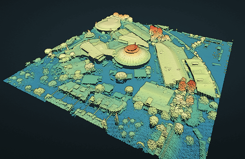
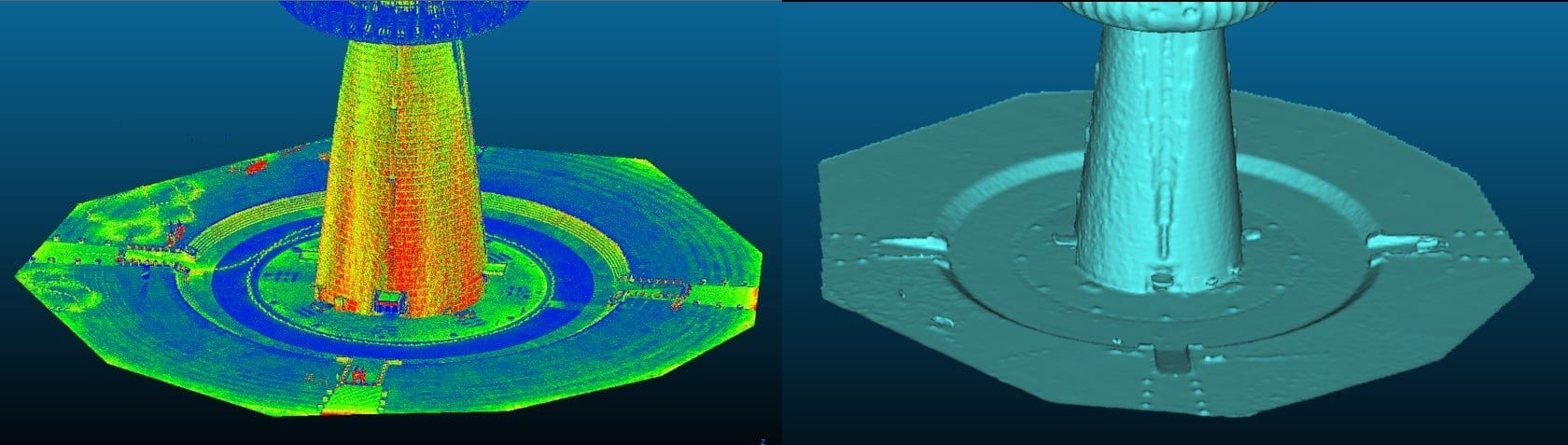
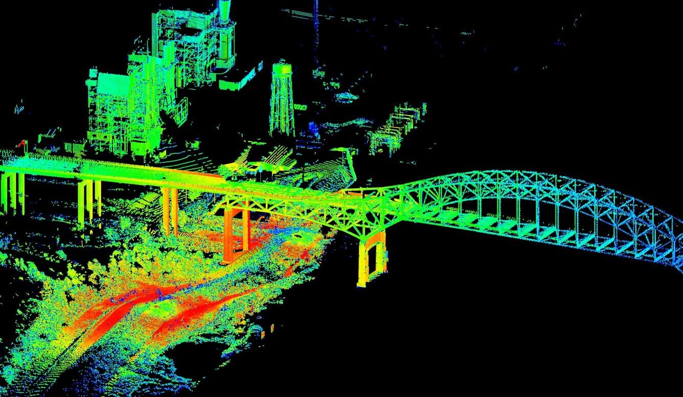
In an oversimplified way, a typical LiDAR system works by continuously shooting lasers, receiving reflected light, and calculating distance, coordinates, and time to generate a LiDAR dataset commonly called a 3D point cloud.
LiDAR shoots light, receives it, and processes data continuously for billions of points to generate a LiDAR dataset, hence the name a 3D point cloud.
A typical LiDAR system consists of four components:
- Laser Scanner: sends rapid pulses of near-infrared laser light.
- LiDAR Sensor: detects and collects the returning light pulses.
- Processor: calculates the time and distance for building the LiDAR point cloud dataset.
- GPS: tracks the location of the LiDAR itself to ensure the accuracy of the measurements.
Because the speed of light is constant, we can calculate the distance easily using the formula d = ct/2, where c is the speed of light and t is the time taken for the light to reflect back. GPS tracks the location of the system to ensure accuracy in the meantime.
Each reflected laser pulse gives us:
- X, Y, Z (coordinates)
- Distance
- Intensity
- Timestamp
Modern LiDAR systems can send up to 500K laser beams per second. By repeating the process across a large area, billions of individual points are processed to build a LiDAR dataset, known as a 3D point cloud.
This raw point cloud frame undergoes several processing steps to create a 3D map/model. First, it is checked for correctness and completeness and cleaned to remove anomalous noise. Second, in the case of self-driving cars, certain features like buildings, road signs, and pedestrians are algorithmically identified and classified.
Algorithms usually downsample the point cloud to remove redundant data and reduce file size. This is necessary because autonomous cars can generate and process a terabyte of data for every hour of operation.
This data is then converted into the industry-standard LAS (Laser) or LAZ file format used for exchanging 3D x, y, z data. Finally, once converted into LAS, the point cloud data can be visualized and modeled into a 3D map/model of the scanned object.
LiDAR Types
Depending on the platform they are mounted, LiDAR types are divided into two categories: airborne and terrestrial LiDAR.
Airborne LiDAR
Airborne LiDAR systems use LiDAR scanners on aircraft (usually helicopters or drones) to generate 3D models of the ground surface.
This LiDAR type is a valuable tool for creating digital 3D models of the surface. These models can then be used to create topographic maps, model flooding, and analyze forest canopy.
Airborne LiDAR systems include:
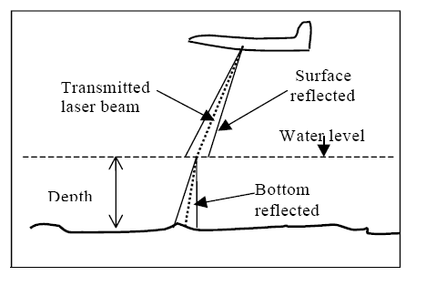
- Bathymetric LiDAR: Bathymetric LiDAR captures GIS (Geographic Information System) data in shallow water along coastlines. Instead of using infrared laser light, this LiDAR system sends green laser beams at a wavelength that can penetrate water to measure the digital elevation of the seafloor.
- Space-based LiDAR: NASA and other space agencies use LiDAR systems for spacecraft navigation and building detailed maps of celestial surfaces. LiDAR also guides NASA's autonomous vehicles and helps control the Ingenuity helicopter during its flights on Mars.
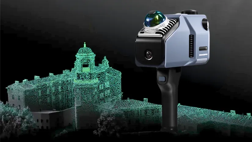
Terrestrial LiDAR
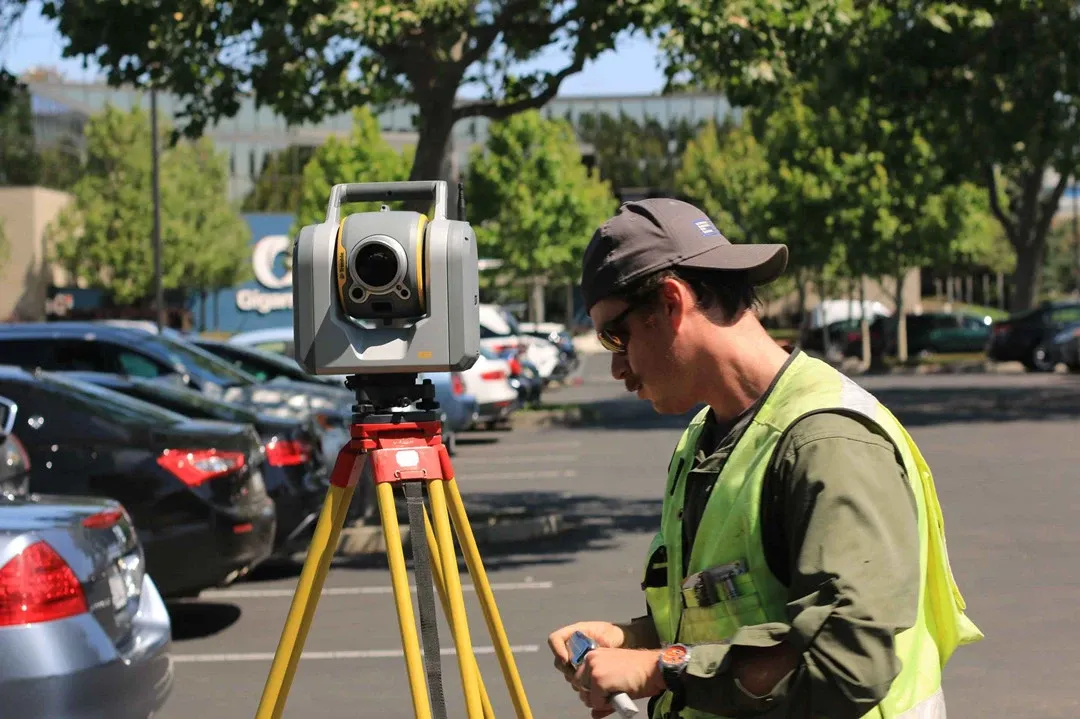
By contrast, terrestrial LiDAR is a ground-based system used for terrestrial mapping and modeling. Its short but precise range makes it ideal for modeling smaller areas with higher precision. This is particularly useful in many industries.
Terrestrial LiDAR systems include:
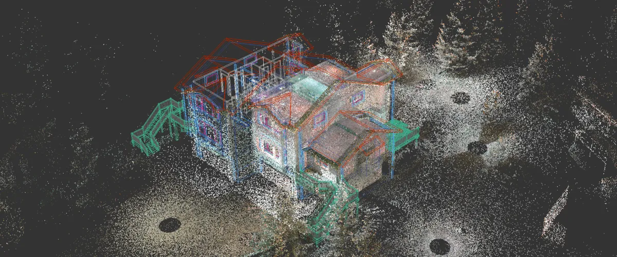
- Static LiDAR: Static LiDAR units stay in one position and capture accurate, repeated scans of the same area. You see them in archaeology, construction, and hazard monitoring. They help track changes in volcano activity, earthquake faults, and flood-prone regions.
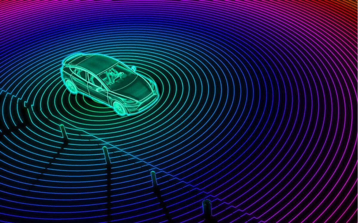
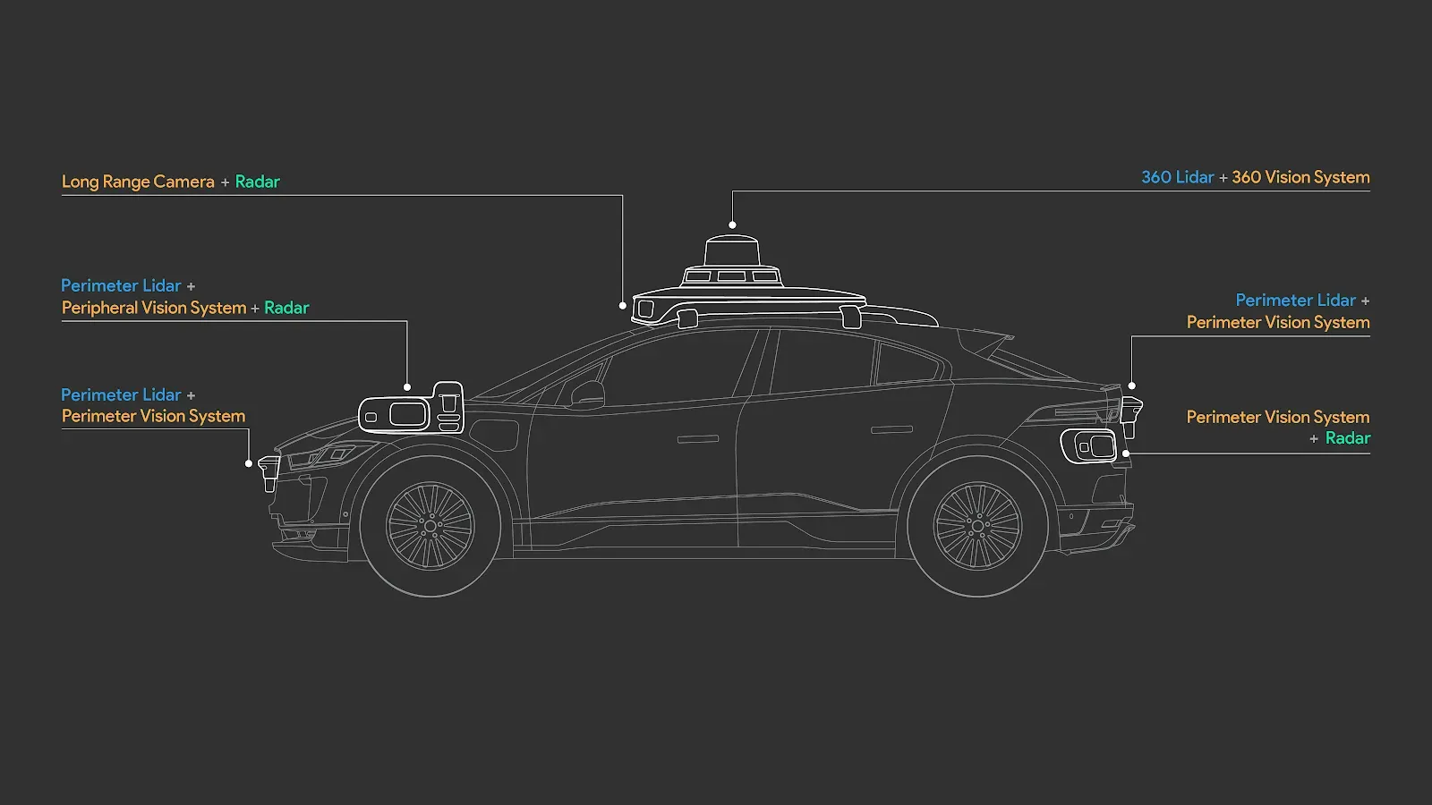
- Mobile LiDAR: Mobile LiDAR collects data while mounted on a moving vehicle. These systems are essential in the automotive sector for building driver-assistance and autonomous driving features. Real-time LiDAR data lets self-driving cars recognize road structures and assets with speed and precision.
LiDAR Applications
In short, LiDAR gives accurate 3D information that helps humans and machines understand landscapes and objects better.
Due to its ability to generate highly precise, detailed 3D models and spatial information, LiDAR technology is widely used across many industries:
- Autonomous vehicles: In addition to RGB cameras, self-driving cars use mobile 3D LiDAR map data to estimate distances and depth. This allows them to "see" and navigate complex road environments, especially in poor light and harsh weather where cameras are by themselves inadequate.
- Construction: Static LiDAR systems can accurately model, map, and survey a construction site or building. This helps architects stress-test the structure for natural disasters. With a precise 3D map of the building, it is possible to forecast the volume of raw materials used for construction.
- Mapping: As mentioned above, airborne LiDAR systems can generate detailed, precise topologies of the surface and shallow waters. These maps are used for various purposes, such as city planning, identifying disaster-prone areas, and monitoring coastline erosion
- Robotics and drones: Robots utilize LiDAR technology for navigation, obstacle avoidance, and SLAM (Simultaneous Localization and Mapping). Drones with airborne LiDAR systems can be used for many practical tasks, such as mapping, agriculture, and defense.
- Geology and mining: Conducting geological surveys is inherently difficult due to landscape, temperature, and distance. In such cases, LiDAR technology can be used for surveying geological features and mapping areas. With precise 3D models of mines, it is possible to calculate mine volumes and explore potential resources.
Conclusion
LiDAR (Light Detection and Ranging) is an advanced technology that emits laser beams to estimate depth that ordinary cameras with RGB images cannot. It measures distances, coordinates, and timestamps to build a 3D LiDAR point cloud.
A typical LiDAR system consists of four components: a laser scanner for emitting light; a LiDAR sensor for receiving reflected light; a processor for calculating and storing 3D coordinates, timestamps, intensity, and distance; and a GPS sensor for tracking objects and the LiDAR system itself.
LiDAR is categorized into two main groups: airborne LiDAR (mounted on aircraft) and terrestrial LiDAR (used on the ground). Because specific use cases require specific adjustments, each category has its own types: bathymetric and space-based for airborne LiDAR, and static and mobile for terrestrial LiDAR.
LiDAR is a practical choice for any task that requires a detailed, precise 3D representation of a landscape, area, or object. This is why LiDAR has many applications beyond topography.
Explore More
Check out these articles to learn more about computer vision:
- 50 Essential Computer Vision Terms (Part I)
- 50 Essential Computer Vision Terms (Part II)
- What is Computer Vision Anyway? [Updated 2026]
References
- Erik Harutyunyan (Mar 31, 2023). LiDAR: What it is, how it works, how to annotate it. SuperAnnotate: Source
- IBM Think (no date). What is LiDAR? IBM Think: Source
- Karyna Naminas (Jan 15, 2025). LiDAR Annotation: What It Is and How to Do It. Label Your Data: Source
- Sayan Protasov (May 14, 2024). Lidar annotation is all you need. Medium: Source
![Best Multimodal ML Data Annotation Tools in 2026 [Comparative Guide]](/content/images/size/w360/2025/12/Robotics--4-.png)